PHOTOS & LINKS
|
|
Maps of the Hanzhong Prefecture Gazetteer of 1813
Drawings by Dr P. Piassetsky during Russian expedition in 1874
List of Scanned Plates from Teichman and others
|
|
|
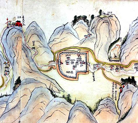
A Route Map for the Main Road from Baoji to the Sichuan Border in the Qing Period
The US Library of Congress has a 55 foot long painted scroll map showing the route and places along the way between Baoji in Shaanxi to the Sichuan border.
The subset to the left shows the walled city of Fengxian. The road passes through this place (which may be present day Fengzhou) and then joins the Lianyun (or “Cloud linked”) route to the Bao River and from there to Baocheng and further to the Shaanxi/Sichuan border. Further information and translated papers about the map can be found on the Qing Period Scroll Map Project web page.
The scroll map has been scanned at high resolution (400 dpi) by the US Library of Congress. A complete set of subset images and printable PDFs have been prepared and can be found HERE. |
|
|
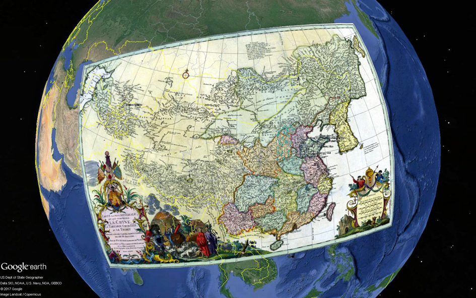
Google Earth KMZ Presentations for Martino Martini and Kangxi Jesuit Maps
In 1655 Martino Martini published his Atlas of China. This was the first of
two main Atlas' produced by Jesuit Brothers based on their mission to China. The second effort between 1704 and 1719
saw Jesuit Brothers and Chinese surveyors map the whole realm of China for the Kangxi Emperor. Maps from this second
survey were copied and printed in Europe by Jean Baptiste d'Anville in 1724 and following years. Further information
and translated papers about the maps can be found at the Kangxi Maps Project web page. |
OTHER PICTURES
|
|
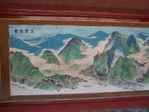
This picture of Ancient Xingzhou (古兴州图, present day Lüeyang, 略阳) is in a mural at the Temple of the River God in Lüeyang. It shows the area at a time when the river traffic was extensive and Xingzhou was a major centre and strategic point along the Old Shu Road joining Fengxian and the Yangping Pass. The strategic importance of Xingzhou was recognised by Zhuge Liang in the Three Kingdoms period.
|
|
|
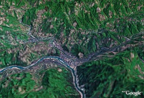
Present day view of Lüeyang from Google Earth. The river running through the pictures is the Jialing River which rises in the Qinling near Dasan Pass and joins the Yangtse River at Chongqing after flowing through Sichuan. |